
Suchergebnisse
Erstelle die Seite „PositionMap“ in diesem Wiki. Siehe auch die gefundenen Suchergebnisse.
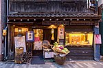 Datei:Illuminated facade of a restaurant serving traditional food with fresh vegetables in Chiyoda, Tokyo.jpg (Kategorie Pages with maps)relative position within image: pct:8.07906,17.9232,87.9239,69.916 relative position within image: pct:7.83894,0,88.9644,88.9196 relative position within…(5.578 × 3.719 (10,65 MB)) - 10:07, 25. Jan. 2024
 Datei:Moshe Ganbash - Shiviti - Google Art Project.jpg (Kategorie 1830s maps of Palestine)English relative position within image: pct:11.9,79.6,75.9,17.3 relative position within image: pct:61.8,12.6,26.6,4.3 relative position within image: pct:37…(4.121 × 3.338 (7,68 MB)) - 11:24, 21. Apr. 2024
 Datei:Warning sign in cologne.jpg (Kategorie Pages with maps)English relative position within image: pct:41.1774,33.132,47.7091,30.318…(2.119 × 1.649 (920 KB)) - 17:33, 22. Mär. 2024
- großflächigen Waldgebieten ist es u.U. schwierig, in Notfällen die genaue Position zu beschreiben. Die staatlichen Landesforsten Rheinland-Pfalz haben durch…26 KB (2.701 Wörter) - 13:44, 2. Mär. 2023
 Datei:Polarlicht 2.jpg (Kategorie Pages with maps)FamCamp can be seen by following the map link from [1] Forest to left Scattered trees in approximately the right positions on the right Lake would be frozen…(3.008 × 1.960 (4,42 MB)) - 16:49, 25. Apr. 2024
- Johanns hielt den Ort für das antike Berenike. Die für den Ort angegebene Position von 24° 0′ n. Br. kann man auch heute noch als genau betrachten. Erneut…20 KB (2.164 Wörter) - 08:52, 15. Jul. 2023
 This SVG map uses required raster graphics to show delicate structures. Detailed map of large dimension. For a better viewing, click on the link of…(2.550 × 1.990 (1,97 MB)) - 06:05, 28. Dez. 2022
 English Eclosion of Melanitis leda (Linnaeus, 1758) – Common Evening Brown - position 4 Wikimedia username: Sarpitabose author name string: Sarpitabose URL:…(6.000 × 4.000 (12,74 MB)) - 07:49, 6. Jan. 2024
 English Eclosion of Melanitis leda (Linnaeus, 1758) – Common Evening Brown - position 2 Wikimedia username: Sarpitabose author name string: Sarpitabose URL:…(4.399 × 3.040 (5,81 MB)) - 07:49, 6. Jan. 2024
- ein gegißtes Besteck ist nicht immer genau genug, ein GPS liefert die Position schnell, sicher und genau, kann aber wegen Strommangel ausfallen. Seekarten…13 KB (1.857 Wörter) - 18:09, 19. Sep. 2020
 English Eclosion of Melanitis leda (Linnaeus, 1758) – Common Evening Brown - position 3 Wikimedia username: Sarpitabose author name string: Sarpitabose URL:…(4.610 × 3.186 (6,61 MB)) - 07:49, 6. Jan. 2024
- bitte einfach auf die POI's klicken, die einen sofort an die beschriebene Position leiten. Die Höhenmeter betragen in Fahrtrichtung Wrexen-Bad Arolsen um…48 KB (4.647 Wörter) - 17:39, 20. Apr. 2024
 1581 Bunting clover leaf map-ar.png Derivative works of this file: خارطة العالم تتوسطها مدينة القدس.jpg English Stylized world map in the shape of a clover-leaf…(4.441 × 3.496 (14,36 MB)) - 00:22, 1. Okt. 2023
 English Map of Scandinavia, Norway, Sweden, Denmark, Finland and the Baltics (undated - no earlier than 1743). determination method: SHA-1…(5.000 × 4.285 (8,31 MB)) - 15:07, 28. Mär. 2023
 Datei:Hamburg, Speicherstadt, Block P -- 2016 -- 3330-6.jpg (Kategorie Tone-mapped HDR images of buildings in Germany)(2016) relative position within image: pct:21.4,74.1,54.4,25.5 shown with features: lighting part of: Speicherstadt relative position within image: pct:75…(5.436 × 3.624 (9,4 MB)) - 13:51, 14. Mär. 2024
 you reproduce this map. There is also a high-resolution version (5 MB) for printing. Direct link to there: http://bell.lib.umn.edu/map/OLAUS/indexo.html…(5.016 × 3.715 (5,22 MB)) - 09:58, 5. Feb. 2024
- offizielle Seite des Landes Nordrhein-Westfalen. · Unter „Themenrouten“ 3. Position im Menue links und dann „Überregionale Themenrouten“ bekommen sie die Radfernrouten…41 KB (4.128 Wörter) - 17:13, 20. Apr. 2024
- 436629.967968 Parkplatz Schwedenwall auf 750 m (hier steht laut OpenStreetMap eine öffentliche Toilette). Durchs offene Feld geht es 4 km lang mit bis…65 KB (6.311 Wörter) - 13:29, 26. Okt. 2023
 Detailed map of large dimension. For a better viewing, click on the link of the image above. Carte détaillée de grande dimension. Pour une visualisation…(3.200 × 1.900 (6,3 MB)) - 12:43, 2. Sep. 2023
- bitte einfach auf die POI's klicken, die einen sofort an die beschriebene Position leiten. 51.412619.657781 Hann. Münden (140 m) - Die Dreiflüssestadt ist…65 KB (6.174 Wörter) - 18:10, 3. Jan. 2024
 Datei:America noviter delineata.jpg (Kategorie Maps in the Library of Congress)English A 17th-century map of the Americas newly delineated by Jodocus Hondius; engraved by H. Picard. Spanish Mapa de América realizado por el cartógrafo…(5.965 × 4.528 (5,17 MB)) - 17:35, 2. Feb. 2024
- (Draupadi); ISBN 9783937603209 Landkarte (1:1½ Mio.): India East: special map: Kolkata (Calcutta); Nelles 2010; ISBN 9783865742292 www.kmcgov.in – Offizielle…33 KB (3.859 Wörter) - 22:15, 16. Mär. 2023
 Datei:Perth (AU), View from Kings Park -- 2019 -- 0525-30.jpg (Kategorie Pages with maps)Authority relative position within image: pct:78.7,72.4,4.9,9.4 named after: Elizabeth Quay named after: Elizabeth II relative position within image: pct:67…(18.791 × 4.516 (33,91 MB)) - 19:51, 22. Apr. 2024
- wie der Twisteweg später einmal verlaufen könnte und stammt aus OpenStreetMap (Stand August 2015). Länge: 41 km Markierung: Der Twiste-Radweg ist als Twisteweg…26 KB (2.170 Wörter) - 15:42, 15. Jul. 2023
- bitte einfach auf die POI's klicken, die einen sofort an die beschriebene Position leiten. Vom Rathaus von Gudensberg mit 51.17849.36751 Gudensberg Rathaus…20 KB (2.067 Wörter) - 14:18, 20. Mär. 2021
 Detailed map of large dimension. For a better viewing, click on the link of the image above. Carte détaillée de grande dimension. Pour une visualisation…(2.096 × 2.341 (2,19 MB)) - 02:56, 15. Apr. 2024
 DescriptionClose wing position mud-puddling and peeing activity of Papilio slateri (Hewitson,1859) – Blue-striped Mime (Male).jpg العربية: ذكر المُحاكية…(2.601 × 1.945 (2,33 MB)) - 20:18, 21. Mär. 2024
- auf die Stabilisierung des Hecks und für eine waagerechte und standfeste Position des Wohnmobils gesorgt werden. Für den optimalen Stand des Wohnmobils helfen…29 KB (3.327 Wörter) - 17:28, 13. Mär. 2024
- wenn man in einem Notfall Hilfe anfordern muss, muss man an eine erhöhte Position aufsteigen. Aus diesem Grund ist auch mit reinen online - Wanderapps Vorsicht…34 KB (2.709 Wörter) - 17:53, 5. Mär. 2023
 Datei:Hamburg, Speicherstadt, Wasserschloss -- 2016 -- 3265-71.jpg (Kategorie Tone-mapped HDR images of buildings in Germany)features: lighting relative position within image: pct:34.1,31.8,21.2,41.8 part of: Speicherstadt part of: Speicherstadt relative position within image: pct:57…(5.309 × 3.318 (8,35 MB)) - 13:55, 14. Mär. 2024
 Datei:Sociable weaver (Philetairus socius).jpg (Kategorie Pages with maps)Creative Commons Attribution-Share Alike 4.0 truetrue English relative position within image: pct:20.9174,22.0546,43.1539,63.7756 start time: 27 December…(3.264 × 3.264 (6,43 MB)) - 09:26, 16. Jun. 2022
- bis 1933. Schon seit 1906 war er als Beigeordneter an einflussreicher Position in der Stadtverwaltung tätig. Das Kriegsende im November 1918 brachte die…177 KB (22.559 Wörter) - 10:38, 5. Feb. 2024
 Datei:Daedongyeojido-full.jpg (Kategorie Featured maps)30000 English: Seoul's large-scale map 한국어: 서울의 대축척 지도 12426 50 1904 1302 17837 30000 center of Seoul's large-scale map 14280 351 701 1152 17837 30000 English:…(17.837 × 30.000 (99,08 MB)) - 09:50, 25. Jan. 2024
 Datei:Danube in Ritopek, Serbia.jpg (Kategorie Pages with maps)Danube au niveau de Ritopek, à proximité de Belgrade, en Serbie. relative position within image: pct:6.6108,48.2709,80,21.902 URL: https://commons.wikimedia…(5.061 × 1.200 (5,06 MB)) - 16:22, 21. Mär. 2024
 Datei:Würfelzucker -- 2018 -- 3564.jpg (Kategorie Pages with maps)white shape: rectangular cuboid made from material: white sugar relative position within image: pct:3.34333,7.78028,93.4351,71.8376 quantity: 12 color: black…(5.349 × 3.343 (9,06 MB)) - 15:52, 15. Apr. 2024
 Datei:Dülmen, Wildpark -- 2017 -- 6075-81.jpg (Kategorie Tone-mapped HDR images of Dülmen)relative position within image: pct:33.2,29.5,36.5,51.5 shown with features: damage shown with features: coarse woody debris relative position within image:…(4.555 × 3.644 (9,92 MB)) - 14:30, 15. Mär. 2024
- Rosette) Harrell, James A. ; Brown, V. Max: The Oldest Surviving Topographical Map from Ancient Egypt : (Turin Papyri 1879, 1899, and 1969). In: Journal of…58 KB (7.442 Wörter) - 18:34, 3. Jan. 2024
 DescriptionClose wing mud-puddling position of Charaxes bharata (C.& R. Felder,1867) - Indian Nawab.jpg English: Mud puddling of Charaxes bharata (C.&…(4.112 × 2.888 (4,98 MB)) - 20:09, 21. Mär. 2024
 DescriptionClose Wing mud-puddling position of Delias berinda (Moore, 1872) – Dark Jezebel.jpg English: Close Wing position of Delias berinda (Moore, 1872)…(4.494 × 3.369 (6,32 MB)) - 18:16, 21. Mär. 2024
 Datei:Münster, LVM, Skulptur -Zwei Pferde- -- 2016 -- 5969-75.jpg (Kategorie Tone-mapped HDR images of Münster (Westfalen))from material: glass architectural style: modern art color: blue relative position within image: pct:73.1,55.5,7.1,19.9 part of: LVM-Campus expression, gesture…(5.025 × 3.350 (8,09 MB)) - 12:43, 17. Mär. 2024
 DescriptionOpen wing basking position of Papilio polytes (Linnaeus,1758) – Common Mormon (Male).jpg English: Open wing basking position of Papilio polytes (Linnaeus…(3.722 × 2.789 (3,1 MB)) - 13:08, 24. Aug. 2023
 If the map is real, then it is public domain by virtue of its age. In the far more likely possibility of it being fake, it is public domain because it…(3.038 × 2.103 (2,48 MB)) - 10:13, 9. Aug. 2023
 Datei:Münster, St.-Paulus-Dom, Altarinsel -- 2019 -- 3815-9.jpg (Kategorie Tone-mapped HDR images of buildings in Germany)religion or worldview: Catholicism made from material: marble relative position within image: pct:46.7,46.2,8.0,11.2 object has role: photographer refine…(5.609 × 4.469 (10,64 MB)) - 14:22, 22. Mär. 2024
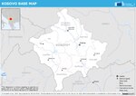 English Base map of Kosovo*. . *"This designation is without prejudice to positions on status, and is in line with UNSCR 1244/1999 and the ICJ Opinion…(1.754 × 1.239 (613 KB)) - 02:22, 4. Nov. 2023
 English: Region of New Zealand, position on the map (source:English Wiki) English…(405 × 590 (7 KB)) - 10:31, 15. Sep. 2020
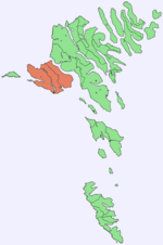 English Position of Vágar, Faroe Islands…(688 × 1.035 (19 KB)) - 08:05, 5. Okt. 2021
 Region of New Zealand, position on the map (source:English Wiki) English…(405 × 590 (7 KB)) - 10:31, 15. Sep. 2020
- Domingo, Santiago de los Caballeros, Puerto Plata, Port-au-Prince; special map: Punta Cana; München 2011 (Nelles), 1:600000, 79 x 50 cm, mit 9 Nebenkt.…72 KB (10.017 Wörter) - 18:10, 10. Mär. 2024
 DescriptionSudan positionmap with districts.svg Positionmap with districts of Sudan for use in templates Date 20 January 2007 Source own work, based on…(725 × 933 (155 KB)) - 14:19, 1. Okt. 2020
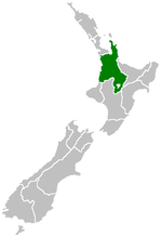 Region of New Zealand, position on the map (source:English Wiki) English…(405 × 590 (7 KB)) - 10:31, 15. Sep. 2020


_%E2%80%93_Common_Evening_Brown_-_position_4.jpg)
_%E2%80%93_Common_Evening_Brown_-_position_2.jpg)
_%E2%80%93_Common_Evening_Brown_-_position_3.jpg)


,_View_from_Kings_Park_--_2019_--_0525-30.jpg)

_%E2%80%93_Blue-striped_Mime_(Male).jpg)

.jpg)


_-_Indian_Nawab.jpg)
_%E2%80%93_Dark_Jezebel.jpg)

_%E2%80%93_Common_Mormon_(Male).jpg)


